A cold front approaching from Ontario is expected to move into the muggy air mass across Southern Quebec on Tuesday.
Daytime highs are expected to climb into the upper 20s with humidex values in the upper 30s.
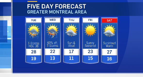
Montreal is expecting a daytime high of 28 degrees Celsius on Tuesday -- which is five degrees above average for the end of August. When you factor in humidity, it will feel more like 38.
Environment and Climate Change Canada issued severe thunderstorm watches in and around Montreal Tuesday but the weather agency lifted the watches just before 6:30 p.m.
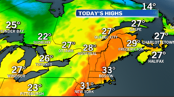
The mercury in Montreal on Monday hit 31.7 C and the humidex hit 40.
Once the cold front moves through, cooler air will follow. The daytime high on Wednesday is expected to be closer to seasonal at 22 C. Montreal could still see an afternoon thunderstorm on Wednesday as the system depart.
Dryer weather is expected for the end of the week.
Temperatures will be below average on Thursday, with the daytime highs only in the upper teens.