Montreal is getting ready to go from rain and record-breaking warmth on Wednesday back to snow and wintery weather Thursday night into Friday.
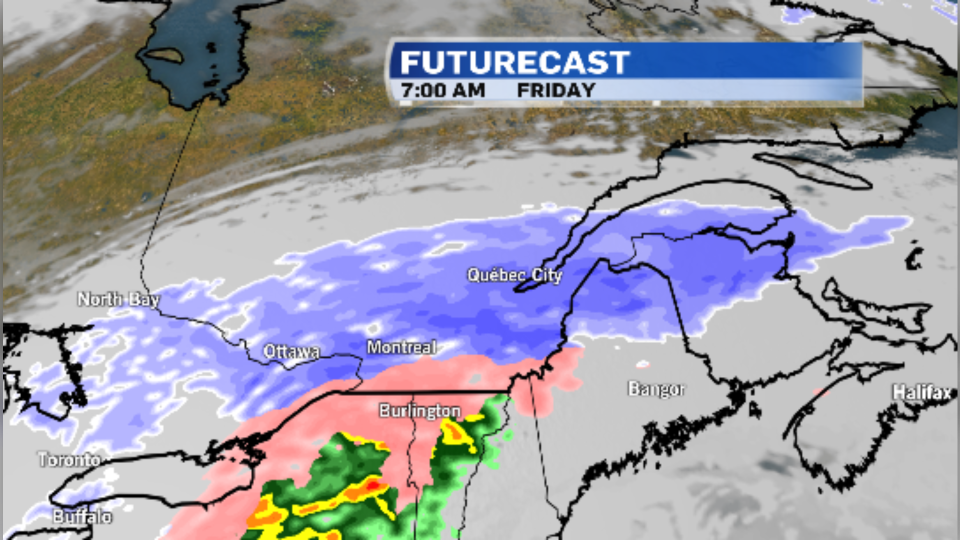
A low pressure system moving up from the United States will bring snow into southwestern Quebec beginning Thursday evening.
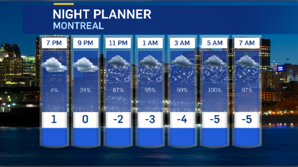
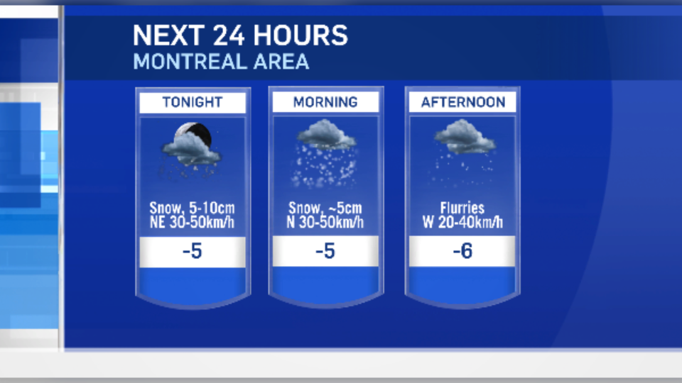
Montreal will see snow begin Thursday after the evening rush-hour, as temperatures drop, and the snow will intensify overnight. The city could pick up 10 to 15 cm of snow into Friday.
Areas south of the city will see a prolonged period of freezing rain Thursday night into the Friday morning rush hour.
Freezing rain warnings have been issued for the Lacolle area, Saint-Jean, Marieville, and much of the Eastern Townships with two to 10 mm of ice expected.
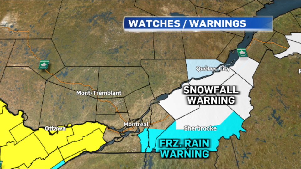
Meanwhile, snowfall warnings are in effect across parts of the Townships and the Beauce with 15 to 25 cm of accumulation in the forecast. Drummondville, Bois-Franc and areas south of Quebec City could see up to 20 cm of snow.
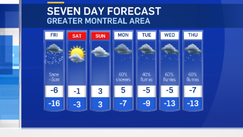
Steady snow will taper to flurries on Friday afternoon and temperatures will fall closer to seasonal averages.
The colder air will be short-lived, as temperatures rebound for the weekend. But a colder weather pattern is expected for much of next week.