

Montreal motorists and pedestrians should expect tricky travel for the end of the week. A low pressure system moving in from the United States will bring a mixed bag of weather that began on Wednesday night.
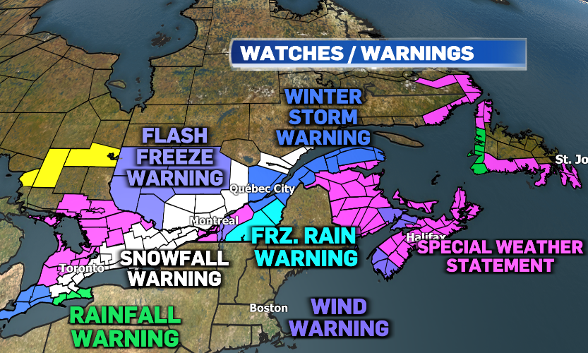
Environment and Climate Change Canada has issued widespread special weather statements across Eastern Canada for the risk of snow, rain, and freezing rain and the agency is even warning people to consider modifying non-essential travel plans.
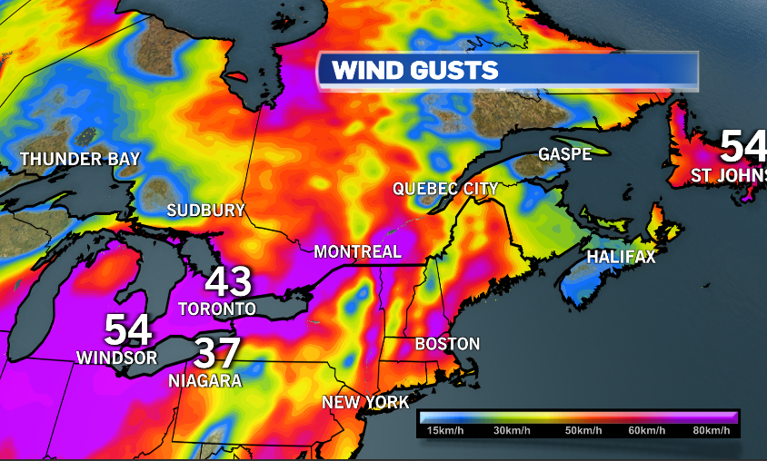
Strong south-westerly winds, with gusts up to 50 km/h in Montreal, are causing temperatures to soar. Montreal could see the temperature rise to 6 degrees Celsius tonight. A wind warning is in effect south of the city with gusts of up to 90 km/h. These strong winds could even result in power outages for areas across the Richelieu Valley and Saint-Hyacinthe.
Montreal will see wet weather begin as rain Wednesday with temperatures above the freezing mark.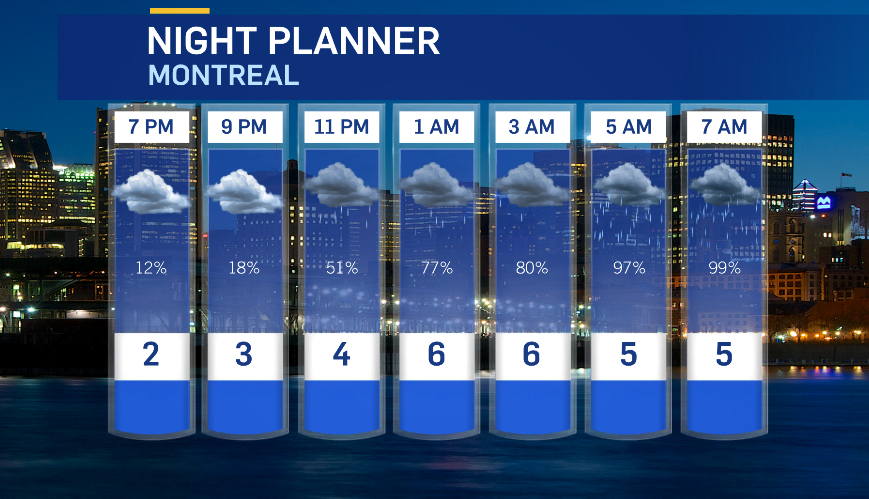
Heavy rain will continue through Thursday morning, making for a tricky commute. Montreal could see in excess of 15 mm of rain, while the Quebec city region is under a rainfall warning for up to 30 mm. The heavy rain could cause flash floods and water accumulation on the roadways.
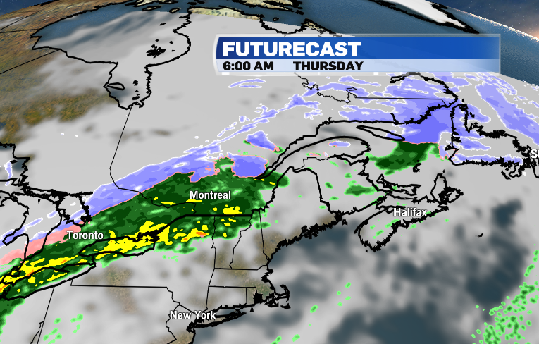
Temperatures are expected to drop through the day on Thursday, and Montreal will see rain change to snow. Depending on the exact track of the system, the city could see more than 15 cm of accumulation Thursday evening through Friday morning.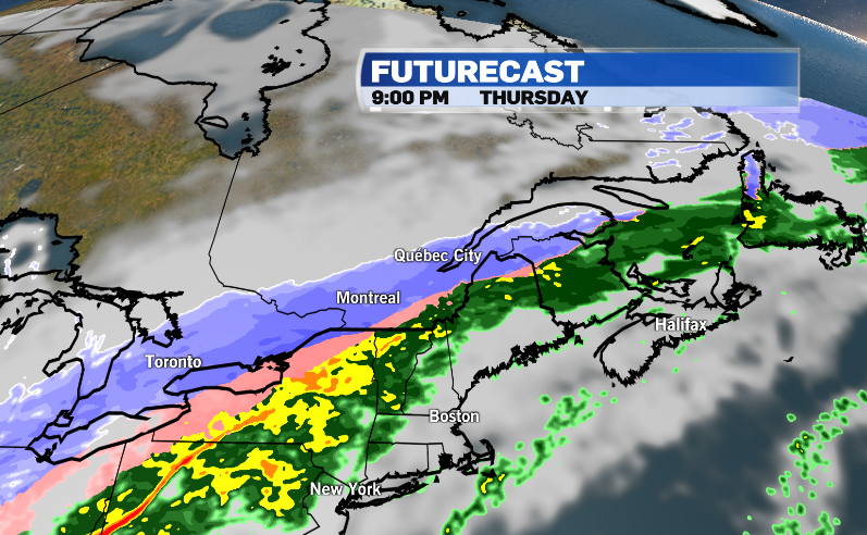
Areas north of Montreal are under a snowfall warning for upwards of 15 cm of snow. Eastern sectors of the province are under winter storm warnings for 15 to 30 cm of snow and very gusty winds. The Eastern Townships is under a freezing rain warning for 2 to 5 mm of ice Thursday night.
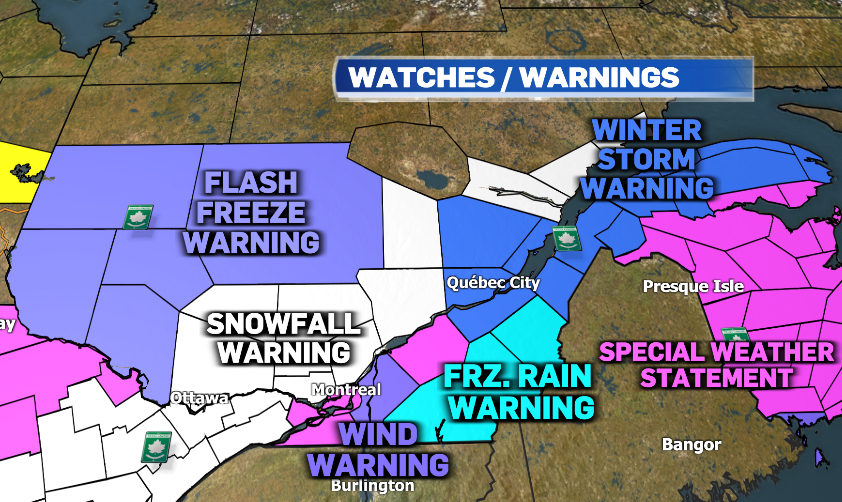
The rapid drop in temperatures has prompted flash freeze warnings north-west of Montreal.
Snowy and icy roads will likely be a challenge through the commute on Friday.


