
The spring equinox is just over a week away but eastern Canada is bracing for another winter storm. A system moving up from the United States is expected to bring Gulf moisture into Quebec, Ontario and Atlantic Canada.
There is still a lot of uncertainty with the exact track of the storm but early indications point to significant snowfall beginning Friday night. Environment and Climate Change Canada has issued special weather statements warning that accumulating snow could be accompanied by strong winds causing blowing snow and reduced visibility on the roads.
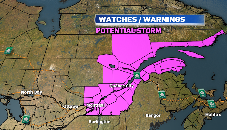
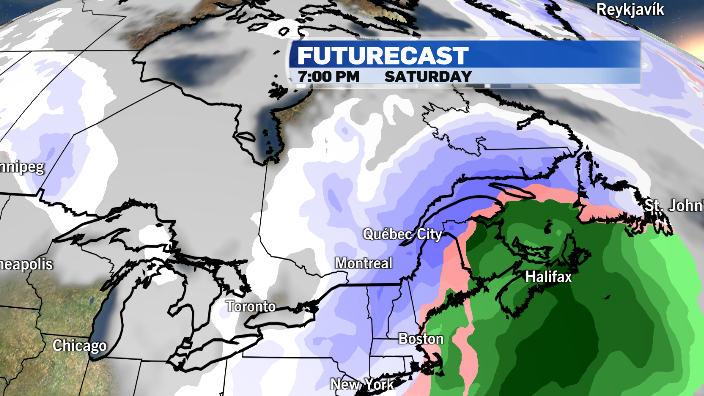
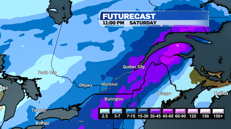
Snow is expected to intensify Friday into Saturday, impacting travel on the roads and in the air. The heaviest snow is expected to fall over eastern regions of Quebec from the Eastern Townships toward the Gaspe Peninsula.
With temperatures remaining below the freezing mark, Montreal could see about 15 centimetres of accumulation.
Montreal has already picked up 15 centimetres of snow in the first week of March, after a very wet February. The city received 165 per cent of its normal precipitation in February with above average snowfall for the month.
Montreal received 54 centimetres of snow in February compared to an average of 41 centimetres.


