Q&A: Researcher confirms two tornadoes in Quebec, predicts stormy summer
The intensity of last Thursday's thunderstorms in the greater Montreal area caught a lot of people by surprise. There were torrential rains, fierce winds and even a tornado in Mirabel.
Experts say climate change likely means we'll see more of the weather conditions that could lead to tornadoes. CTV news anchor Maya Johnson spoke with David Sills, Executive Director of the Northern Tornadoes Project at Western University.
This interview has been edited for clarity and concision.
Q - Let's start with a recap. What has now been confirmed in terms of the number of tornadoes we saw touchdown last week in Quebec and Ontario?
A - After that big line of storms went through Ontario, and Quebec we had survey teams out collecting data. So right now we have the Quebec results all completed as of today. And actually, there were two tornadoes in Quebec. One was that Mirabel tornado which had a default EF zero rating, because there was no damage that was reported with that. But there was also another tornado, EF zero, so lowest on the EF scale at St. Thomas. In addition to that, five downbursts in Sainte-Anne-des-Plaines, Sorel Tracy and Saint-Anicet.
Q - What's the difference between a downburst and a tornado?
A - Now that's a good question! So a simple answer is with a tornado, you've got air coming in towards the storm and up into the tornado area. And with a downburst, you've got air that's rain cooled, that's falling out of the thunderstorm and spreading out and causing damage at the ground.
So you can imagine, because of those different air patterns, you're getting a different damage signature. And that's what we look for when we send teams out to do the damage surveys, is to look for those different damage patterns. One is kind of widespread damage, usually fairly weak, whereas the other tornado damage will be a long narrow path and can be much, much stronger.
Q - Can you put all of this into perspective for us? Are we seeing more tornadoes and downbursts? Or do we not have enough reliable data yet to draw that conclusion?
A - There are some modeling studies that suggest that in the future, there may be less tornadoes in the West, more in the East. And you know, our observations with the northern tornadoes project since 2017, have supported that idea. There have been a lot of tornadoes in Eastern Ontario and southern Quebec, and not as many as we expected on the prairies. As far as the number of tornadoes increasing, we have to collect a lot more data to see if those climate models are panning out.
Q - Do you think we'll be seeing more of this in the future? Is it hard to say right now?
A - Well, this is actually peak season across Canada, July is the month for tornadoes and basically all severe storm activity across the country. So we're right in the thick of it. We'll probably have lots of storms and the chance for more tornadoes and downbursts. Hopefully, nothing really devastating. Right into August and maybe the beginning of September and then it all starts to wind down.


CTVNews.ca Top Stories
DEVELOPING
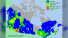
DEVELOPING 122 active wildfires burning across Canada, 32 considered 'out of control'
The 2024 wildfire season has begun, and it's shaping up to follow last year's unprecedented destruction in kind, with thousands of square kilometres already consumed.
B.C. parents sentenced to 15 years for death of 6-year-old boy
A British Columbia Supreme Court judge has sentenced the mother and stepfather of a six-year-old boy who died from blunt-force trauma in 2018 to 15 years in prison.
Veteran TSN sportscaster Darren Dutchyshen has died
Veteran TSN broadcaster Darren 'Dutch' Dutchyshen, one of Canada’s best-known sports journalists, has died. He was 57. His family says 'he passed as he was surrounded by his closest loved ones.'
Miller scores late as Canucks grind out 3-2 win over Oilers in Game 5
J.T. Miller scored in the final minute of the game and the Vancouver Canucks came back for a 3-2 victory over the Edmonton Oilers in Game 5 of their second-round playoff series Thursday.
Think twice before sharing 'heartbreaking' social media posts, RCMP warn
Mounties in B.C. are urging people to think twice before sharing "heartbreaking posts" on social media.
Police issue Canada-wide warrant for Regina homicide suspect
Police have issued a Canada-wide warrant for a man wanted in a homicide which occurred in Regina on May 12.
Trudeau calls New Brunswick's Conservative government a 'disgrace' on women's rights
Prime Minister Justin Trudeau assailed New Brunswick's premier and other conservative leaders on Thursday, calling out the provincial government's position on abortion, LGBTQ youth and climate change.
Kevin Spacey receives star support as he fights to get his career back
Kevin Spacey is pushing back on the 'rush to judgment' against him and is being backed by some big names as he seeks to reclaim his acting career.
Speaker cuts ties with Sask. Party, alleges he faced threats, harassment from gov't MLAs
The Speaker of the Saskatchewan Legislature Randy Weekes has severed ties with the Sask. Party after accusing some members of harassment and intimidation tactics, including a situation he claimed saw the Government House Leader bring a hunting rifle to the legislative building.
Shopping Trends
The Shopping Trends team is independent of the journalists at CTV News. We may earn a commission when you use our links to shop. Read about us.


Toronto
-

Faqiri family calls out Ontario gov't for lack of action on inquest recommendations
Five months after a coroner's inquest into the death of a mentally ill man at an Ontario jail, his family said Thursday the province has failed to implement any of the dozens of recommendations aimed at preventing similar deaths in the future.
-
A Toronto man killed his mother and decapitated her. His lawyers argue it wasn't murder
A ‘lifetime of abuse’ led Dallas Ly to snap and repeatedly stab his mother inside their Leslieville apartment in 2022 but he never intended to kill her, his defence lawyers argued during his murder trial in Toronto on Thursday.
-
Ontario's so-called 'Crypto King' soliciting investments as recently as February: police
Ontario’s so-called 'Crypto King' Aiden Pleterski was soliciting new investors as recently as February – a year-and-a-half after he was petitioned into bankruptcy for allegedly running a Ponzi scheme worth more than $40 million – police alleged on Thursday.
Ottawa
-

Eliminating English-only education on table of OCDSB program review
More reaction is coming from parents as the Ottawa-Carleton District School Board looks to make major adjustments to its elementary programs including French immersion and how it is delivered.
-
Ottawa daycares struggling under $10-a-day program
It's been a rocky start to the $10-a-day daycare program in Ontario. There still aren't enough spots and many daycares are short funding and say they may opt-out all together.
-
Man jumps from second floor to escape fire in Ottawa's Alta Vista neighbourhood
The Ottawa Fire Service says firefighters responded to a call for a fire on Tall Oak Private, near the Ottawa Hospital General Campus, at approximately 9:30 a.m.
Atlantic
-

'We're rich!': New Glasgow, N.S., couple wins big in Lotto 6/49 draw
A Nova Scotia couple is $5 million richer after winning the latest Atlantic Lottery 6/49 draw.
-
Transport truck drives off overpass in Lower Sackville, N.S., landing on highway below
A section of Highway 102 is closed Thursday evening after a transport truck drove off an overpass.
-
'It's overwhelmingly painful': Theology professor shares insight on impact Maritime church closures have on some
A growing trend of century-old churches being closed, sold and/or demolished in the Maritimes is a sad reality many parishioners are starting to get used to.
N.L.
-

Study says aquaculture likely driving wild salmon extinction in Newfoundland
A new study shows an Atlantic salmon population in southern Newfoundland is disappearing, and it says nearby aquaculture operations are a likely contributor to the decline.
-
'Irate male' assaulted Newfoundland officers with block of cheese, police say
Police in Newfoundland say patrol officers were assaulted Thursday by a "very irate male" wielding a block of cheese.
-
Whooping cough outbreak declared in Newfoundland
Health officials say there is an outbreak of whooping cough in eastern Newfoundland.
Northern Ontario
-

Northern Ont. police searching for second stabbing suspect
One person is in custody while a second suspect is on the loose following a stabbing that sent two people to hospital in northern Ontario, police say.
-
Timmins council told it can’t evict people from encampments on public property
A legal clinic from southern Ontario is reminding Timmins city council that it’s “unlawful” in Ontario to evict people from homeless encampments on public property.
-
Long lineups at Sudbury's landfill because of scale repairs
Repairing the scales at Sudbury’s main landfill site on The Kingsway is causing delays and long lineups for residents and businesses using the site to dispose of waste and trimmings.
London
-

Unique circumstances lead OPP to reveal name of 'homicide/suicide' victim
It’s been three months since 38-year-old Tanya Wiebe was found dead inside a home on Roberts Line in Central Elgin.
-
Father takes stand at child sexual abuse trial
The father at the centre of a child abuse case in London, Ont. took the stand Thursday in his own defence, pointing the finger at his estranged wife.
-
Dangerous and derelict, city hall targets three houses for property standards demolition
LIving next to the boarded up house at 219 Adelaide St. N. for two years has taken a toll on Theresa Mullins and her family.
Kitchener
-

Puppies found abandoned in box by Hwy. 401 ramp
The local humane society is asking for the public's help to care for five puppies that were found abandoned in a box near Hwy. 401 in Kitchener.
-
Waterloo, Ont. escape room broken into – again
Most people want to break out of an escape room. A Waterloo, Ont. business, however, has been broken into – not once – but twice.
-
Waterloo MPP calls PC government’s move on sexual assault justice bill 'cruel'
A Waterloo MPP is speaking out after her private member’s bill, aimed at improving transparency around sexual assault cases, was pulled from debate.
Windsor
-

Police seize over $250,000 in drugs, arrest 53-year-old man
Windsor police officers have arrested one suspect and seized over $250,000 in illegal drugs after an investigation.
-
By the numbers: Gordie Howe International Bridge
Just 26 metres is all that remains of bridge deck construction on the Gordie Howe International Bridge between Windsor and Detroit.
-
'This is really about saving a life': Victims and Survivors of Crime Week focusing child abuse in Windsor-Essex
The Windsor Essex Child/Youth Advocacy Centre (WECYAC) is calling on the community to learn more about local services as part of Victims and Survivors of Crime Week 2024.
Barrie
-

Out with Loblaws, in with Zehrs in Barrie's north end
Zehrs has returned to the north end of Barrie.
-
Family of man killed in Springwater hit-and-run speak out at sentencing hearing
Six months after being found guilty of a fatal hit and run in 2018 that claimed the life of Dominik Adamek in Springwater Township, Maimuna Baldeh heard from his grieving family, who told the court about the pain they've endured since that day.
-
Wasaga Beach mayor hears from residents over multiple pivotal projects
Many people turned out to the RecPlex in Wasaga Beach on Thursday night as the mayor and councillors opened a dialogue amidst multiple momentous decisions they've made in recent months.
Vancouver
-

Miller scores late as Canucks grind out 3-2 win over Oilers in Game 5
J.T. Miller scored in the final minute of the game and the Vancouver Canucks came back for a 3-2 victory over the Edmonton Oilers in Game 5 of their second-round playoff series Thursday.
-
B.C. parents sentenced to 15 years for death of 6-year-old boy
A British Columbia Supreme Court judge has sentenced the mother and stepfather of a six-year-old boy who died from blunt-force trauma in 2018 to 15 years in prison.
-
'Another pair of eyes watching over me:' How a B.C. woman's guide dog saved her from drowning
A B.C. woman says her guide dog pulled her from a lake moments before she had a seizure, saving her life.
Vancouver Island
-

B.C. parents sentenced to 15 years for death of 6-year-old boy
A British Columbia Supreme Court judge has sentenced the mother and stepfather of a six-year-old boy who died from blunt-force trauma in 2018 to 15 years in prison.
-
Eby warns about United-Conservative merger, says B.C. voters face 'starkest choice'
Premier David Eby delivered an election-style speech to his New Democrat caucus, warning of the potential merger between the opposition BC United and B.C. Conservative parties, saying the fall election is shaping up to be the "starkest choice in a generation."
-
B.C. nurse suspended for 'significant' privacy breaches
A nurse in Metro Vancouver has been suspended for two weeks and ordered to take remedial education after she accessed the personal health records of several people for no work-related purpose.
Winnipeg
-

‘Great candidates for adoption’: Second chance for 68 dogs seized from Winnipeg home
A second chance could be coming for dozens of dogs seized from inhumane conditions at a Winnipeg home.
-
Severe thunderstorm rolls through Winnipeg, bringing hail and heavy rain
A severe thunderstorm warning is in effect for Winnipeg, producing heavy rain and hail in some areas of the city.
-
Calgary
-

Massive fire breaks out at Wrangler Road facility
Smoke and flames could be seen from kilometres away, prompting numerous 911 calls after a blaze broke out on the eastern edge of Calgary near Glenmore Trail and Stoney Trail S.E.
-
'Need to strike a balance': Calgary looks to density and development to tackle its housing crisis
As a housing crisis continues in Calgary, the city is looking to strike a balance between increasing density – both in established neighbourhoods and in new ones.
-
'Wanting everybody to feel comfortable and welcome': Alberta couple killed in highway crash remembered
Family and friends are mourning the loss of an Alberta couple who were killed Sunday in a highway crash northwest of Lethbridge, Alta.
Edmonton
-

Fort McMurray evacuees in Edmonton say they've been forced to spend hundreds on hotels, supplies
Some Fort McMurray evacuees say they're struggling to access supplies and accommodations after leaving their homes and travelling to Edmonton.
-
Miller scores late, Canucks edge Oilers to regain series lead
A late goal by J.T. Miller broke a deadlock that had lasted for almost two periods, grabbing a shot that had deflected off the post and sweeping it past goalie Calvin Pickard with 31.9 seconds left in the third period to lift the Vancouver Canucks to a 3-2 win over the Edmonton Oilers.
-
Edmonton police commission faces anger from public over police response at U of A encampment
The Edmonton Police Commission heard on Thursday from almost a dozen angry speakers demanding police accountability after the teardown of a protest encampment from the University of Alberta.
Regina
-

Sask. teachers vote to renew mandate for job sanctions
Saskatchewan teachers have voted heavily in favour of a new mandate that allows job action to continue until an agreement with the province is reached.
-
Police issue Canada-wide warrant for Regina homicide suspect
Police have issued a Canada-wide warrant for a man wanted in a homicide which occurred in Regina on May 12.
-
Speaker cuts ties with Sask. Party, alleges he faced threats, harassment from gov't MLAs
The Speaker of the Saskatchewan Legislature Randy Weekes has severed ties with the Sask. Party after accusing some members of harassment and intimidation tactics, including a situation he claimed saw the Government House Leader bring a hunting rifle to the legislative building.
Saskatoon
-
Sask. teachers vote to renew mandate for job sanctions
Saskatchewan teachers have voted heavily in favour of a new mandate that allows job action to continue until an agreement with the province is reached.
-
Saskatoon blind, deaf water skier ready to make waves at world championships
A Saskatoon water skier who is blind and deaf has partnered with a well-known artist to fundraise for the national adaptive water ski team.
-
Saskatoon is losing one of its Giant Tiger discount stores
Giant Tiger has announced that the company is closing a number of stores including one location in Saskatoon.