

MONTREAL -- After a rather cloudy but mild stretch of weather this December, southern Quebec will finally be seeing some sun. But there is a catch -- it comes along with the coldest air of the season so far, thanks to the polar vortex.
The polar vortex -- that expanse of bitterly cold air usually concentrated around the North Pole -- is sinking south.
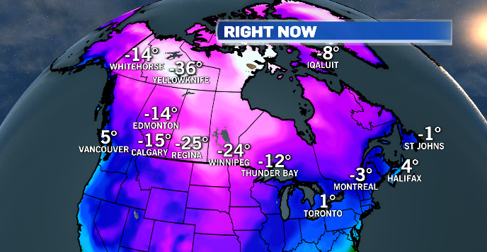
Frigid air is already gripping parts of the Prairies. The core temperature in Regina Monday morning was -29 degrees Celsius and the city reported a wind chill of -41.
TEMPERATURES MONDAY MORNING
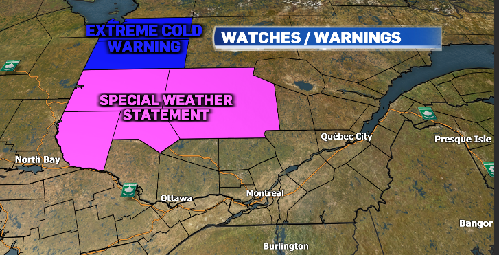
The colder air affecting Western Canada will be sliding into parts of Quebec and Ontario beginning tonight. Environment and Climate Change Canada has already issued extreme cold warnings for northwestern Quebec, where wind chills are expected to be around -38 Monday night.
Areas just south of that warning zone, including Abitibi-Temiscamingue, are under a special weather statement with wind chills expected to be around -35.
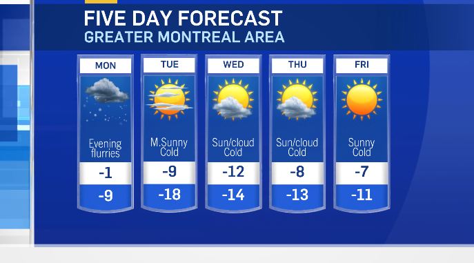
In Montreal, the temperature will drop to near seasonal Monday night, but the mercury will continue to fall steadily through the day on Tuesday.
By Tuesday night, Montreal will see a low around -18 degrees Celsius and a wind chill around -25: cold but not record-breaking. (The record low for December 15 is -28.3 in 1943.)
Temperatures will continue to be below average right through the week with milder air moving back in for next weekend.
Normal high: -3 degrees Celsius
Normal low: -11 degrees Celsius


")


