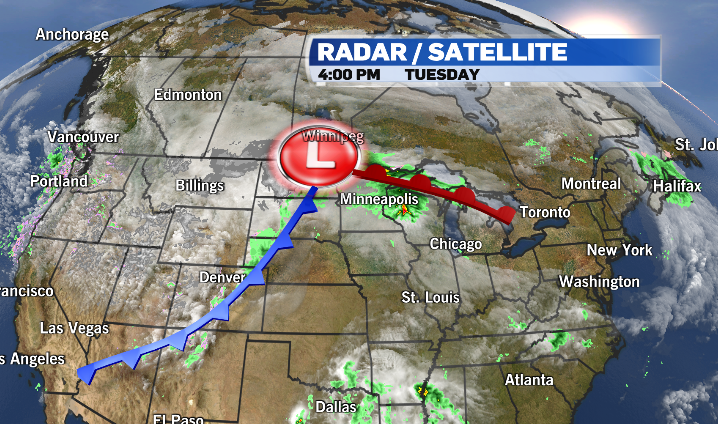
It's being called the biggest April snowstorm in decades, and it's moving into parts of Western Canada tonight.
Environment and Climate Change Canada has issued blizzard warnings for southeastern Saskatchewan and parts of southern Manitoba, where 30 to 50 centimetres of snow is expected to fall.
Accumulations could be as high as 80 cm near the U.S. border.
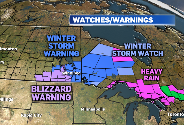
Heavy snow combined with wind gusts up to 90 km/h will reduce visibility and lead to hazardous driving conditions. People are being urged to stay off the roads.
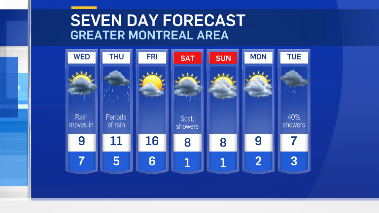
The same system is expected to bring periods of heavy rain into parts of central Canada. Parts of southwestern Quebec are under rainfall warnings, with 20 to 30 millimetres in the forecast for Wednesday into Thursday.
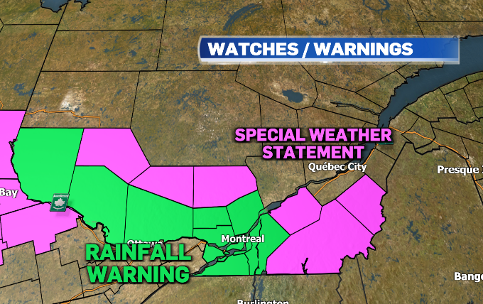
The Eastern Townships are under a special weather statement for 15 to 25 mm of rain.
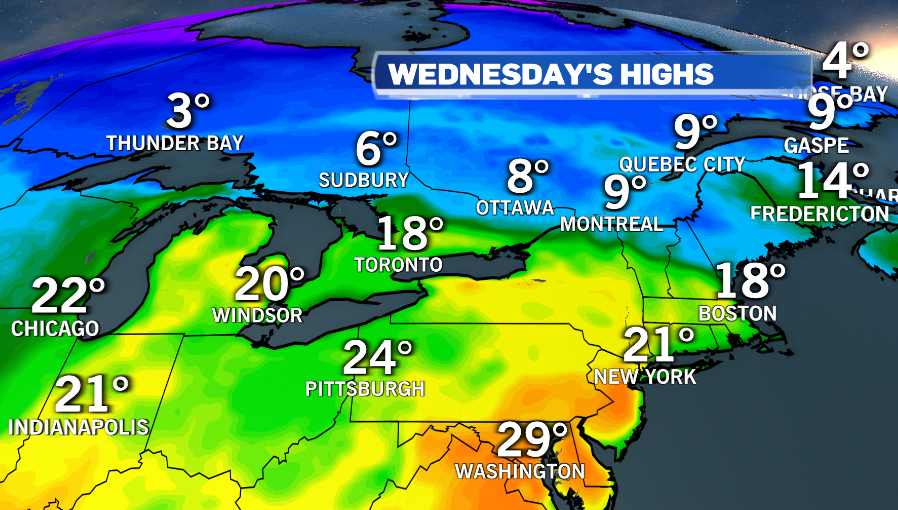
The warm front is expected to bring rising temperatures into Southern Ontario. But Montreal will be shut out of the heat. Daytime highs on Wednesday are expected to be in the single digits.
Montreal will see a break in the precipitation on Friday, however, as sunshine returns and temperature soar back into the mid teens.
But as the entire system tracks toward Atlantic Canada, it will leave southwestern Quebec with below-average temperatures through most of the holiday long weekend.