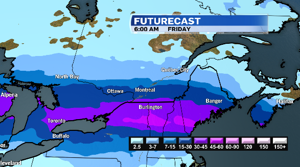
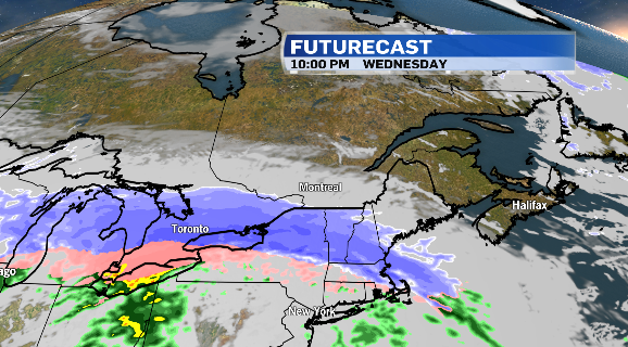
A Colorado low is moving into central Canada today and will bring a messy mix of heavy snow, freezing rain and ice pellets, as well as gusty winds.
Environment and Climate Change Canada has issued a number of warnings, alerting motorists to potentially hazardous driving conditions Wednesday through early Friday morning.
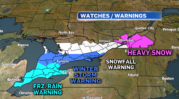
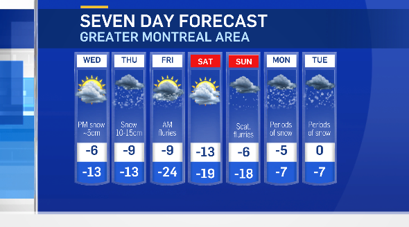
Montreal is under a blowing snow advisory with up to 15 centimetres of snow and wind gusts up to 50km/h reducing visibility on the roads. The snow will push into the Montreal-are late Wednesday night and continue through early Friday morning.
Areas just south of the city, like Vaudreuil-Soulanges-Huntingdon are under a snowfall warning for up to 20 cm of snow.
Meantime, there are widespread freezing rain warnings in place across Southern Ontario. Areas from Windsor up toward Hamilton will see hours of freezing rain. Ten to 20 mm of ice buildup is possible which could cause tree branches to come down and could result in extensive power outages.
Winter storm warnings are also in effect from Toronto toward Kingston where up to 15 cm of snow, mixed with ice, pellets and pockets of freezing rain will be possible.
Ottawa is under a snowfall warning for 15 to 20 cm of snow.
Motorists are being warned to adjust their driving to the changing road conditions. Surfaces such as highways, roads and sidewalks will be difficult to navigate.
As the system departs on Friday, colder air will move in. Montreal will see an overnight low of -24 degrees Celsius, more than 10 degrees below normal. Temperatures will gradually moderate into next week, however, more accumulating snow is possible Monday into Tuesday.