

The stretch of unseasonably warm temperatures is expected to continue across southwestern Quebec this week after Montreal broke a 59-year-old weather record on Wednesday.
The previous record for Oct. 25 was set in 1963 when the temperature reached 23.9 C. Environment Canada confirmed Montreal set a new record Wednesday when the temperature hit 24 C. The humidex on this unusually warm fall day also hit a surprising high of 30.
Daytime highs have been roughly 10 degrees above average for the past three days in parts of Quebec and Ontario, with numerous temperature records broken. Montreal hit highs of 21.8 C on Saturday, 20.8 C on Sunday and 20.1 C on Monday.
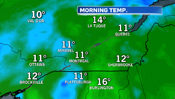
On Tuesday, Montreal started the day at 11 C, which is the normal daytime high for October 25.
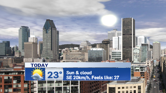
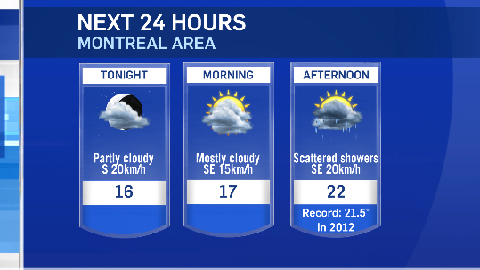
Although Montreal will see a few showers move in on Wednesday, the warm weather is expected to continue. The city is expecting a high of 22 C, which would set a new record for Oct. 26, beating the current record high of 21.5 C set in 2012.
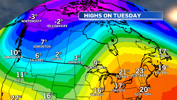
While eastern Canada is seeing record-breaking warmth, western Canada has already had its first taste of winter. Calgary picked up 23 cm of snow over the weekend, and parts of Saskatchewan and Manitoba were under snowfall, winter storm and freezing rain warnings to start the week.
Temperatures in many prairie cities will stay below average, with daytime highs just above freezing through the end of the week.
A front that brought wicked winter weather to the west will move into Quebec on Wednesday.
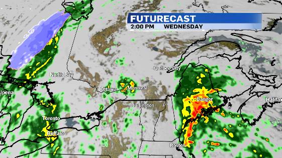
Montreal will see a few showers with this system, with temperatures starting to drop toward the end of the week. The coolest day is expected to be on Friday, but temperatures will be no colder than what is seasonal.
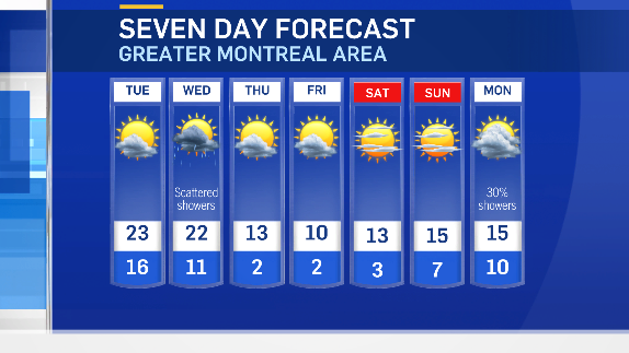
Slightly above-average temperatures and sunshine are expected to return for the weekend. At this point, the outlook for Halloween on Monday is for mild air.


