

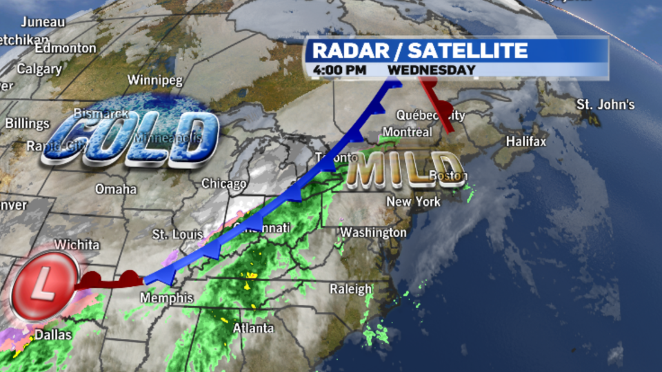
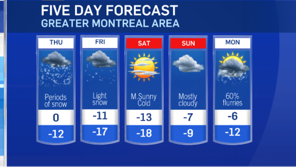
After a brief break from the intense cold, wintery weather is expected to return to Southern Quebec on Thursday.
A low-pressure system moving up from Texas will merge with a cold front sweeping across the province, and with temperatures dropping through the day wet weather is expected to fall in the form of snow.
Montreal will often find itself on the very edge of this band of precipitation, making snowfall predictions tricky. But with steady snow in the forecast through Thursday, the city could receive as much as 15 centimetres of accumulation. Breezy northeasterly winds will cause local blowing snow, making for a difficult commute.
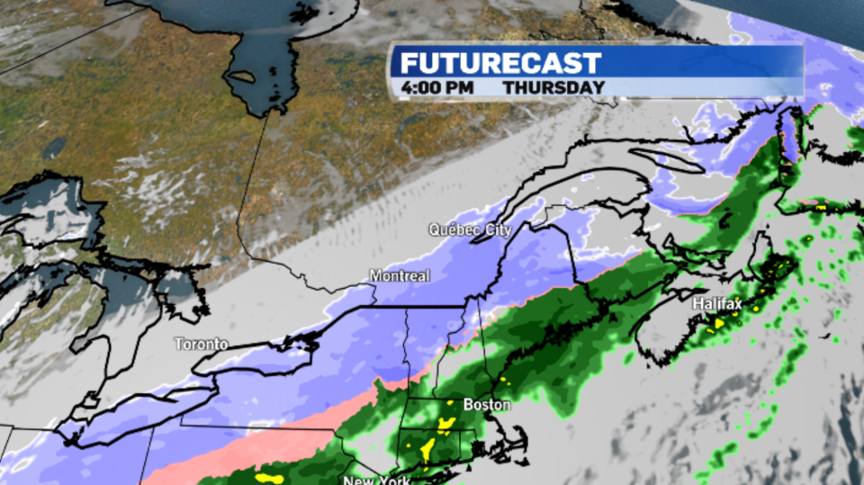
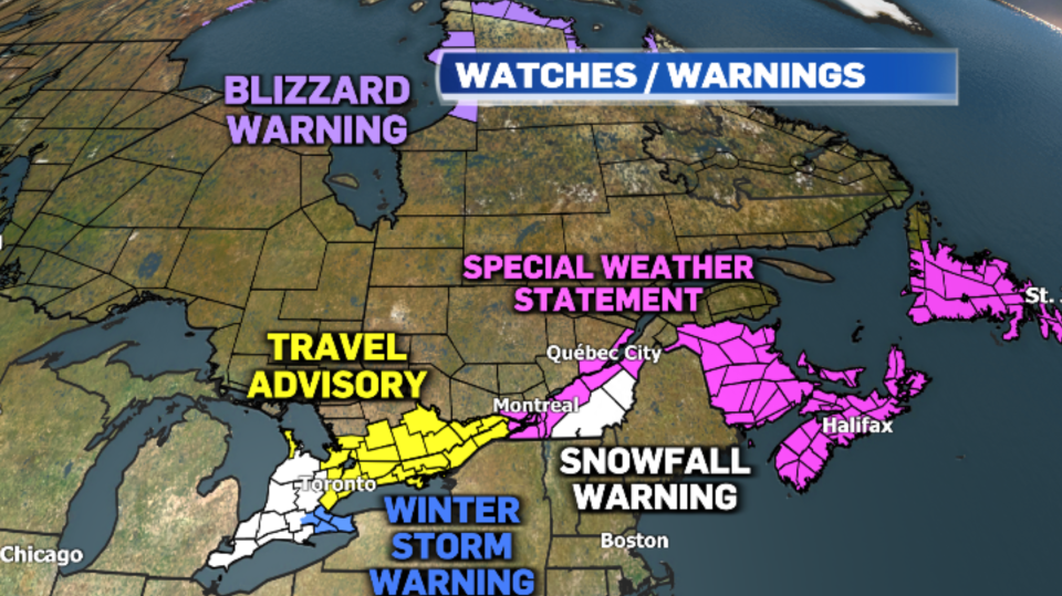
The heaviest snow is forecast to track across the Eastern Townships and the Beauce. Environment and Climate Change Canada has issued snowfall warnings for those regions with 15 to 25 cm possible.
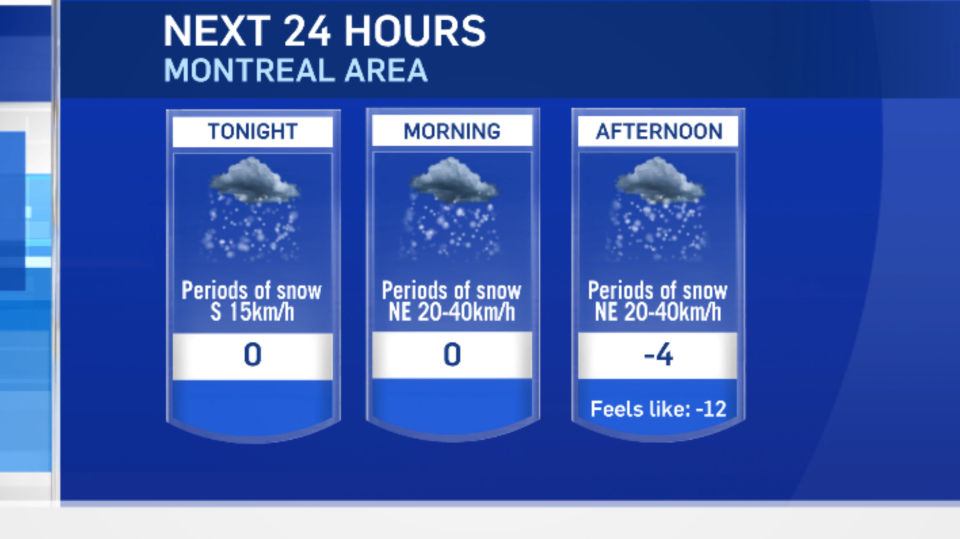
After a brief break from the intense cold, arctic air will be returning. Montreal made it up to a high of 4 degrees Celsius on Wednesday, which is 10 degrees above average. But temperatures will be dropping again through the day on Thursday. Montreal will dip to -4 C in the afternoon, with a wind chill of -12. And the low will drop to -12 C at night.
Colder air is in the forecast to kick off the weekend, but temperatures will begin to moderate on Sunday.
NORMAL HIGH: -5 C
NORMAL LOW: -14 C


