
Southern Quebec will be hit with a powerful storm system that will bring "significant" snowfall, strong winds and some rain near the end of the week, prompting warnings to drivers ahead of the busy holiday weekend.
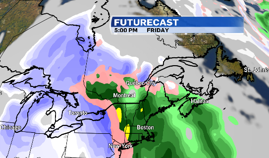
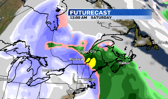
Environment Canada said an "intense" low-pressure system is set to arrive in the area Thursday night until Saturday and could make for some messy driving conditions.
A special weather statement issued Monday covers several regions, including Montreal, Laval, Longueuil, and the Châteauguay-La Prairie area.
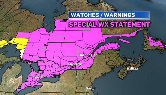
The weather agency warned of a mix of heavy snow and blowing snow for areas north of the St-Lawrence River, while regions to the south could see rain instead of snow.
"As there is some uncertainty related to the track of the system, it is still too early to provide details regarding expected amounts," Environment Canada said in the weather bulletin.
Strong tides could also bring storm surges to parts of Quebec City beginning Friday.

As colder air moves over the Great Lakes, parts of southern Quebec could see snow squalls into the weekend.
"Plan ahead for your holiday travel plans. Road conditions will be difficult and power outages are possible," according to Environment Canada.
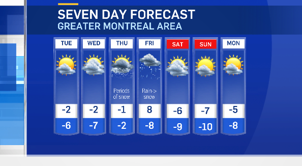
Although the forecasted high for Friday is calling for a balmy 9 C, temperatures are expected to plummet, with a high of -8 C by Sunday.
The normal temperature for this time of year is -3 C.
The temperature is expected to hover around the freezing mark until Friday.
Montreal got its first real snowstorm last week with about 37 centimetres falling from Friday to Sunday morning.
MONTREAL STORM WATCH
- Environment Canada weather alerts - southern Quebec
- STM bus line status
- Metro service updates
- Montreal-Trudeau Airport Departures | Arrivals
- Exo commuter train status
- Via rail trains status
- City of Montreal snow removal, parking, towing
- Free parking spots
- My car was towed
- Laval snow removal operations
- Longueuil snow removal operations


