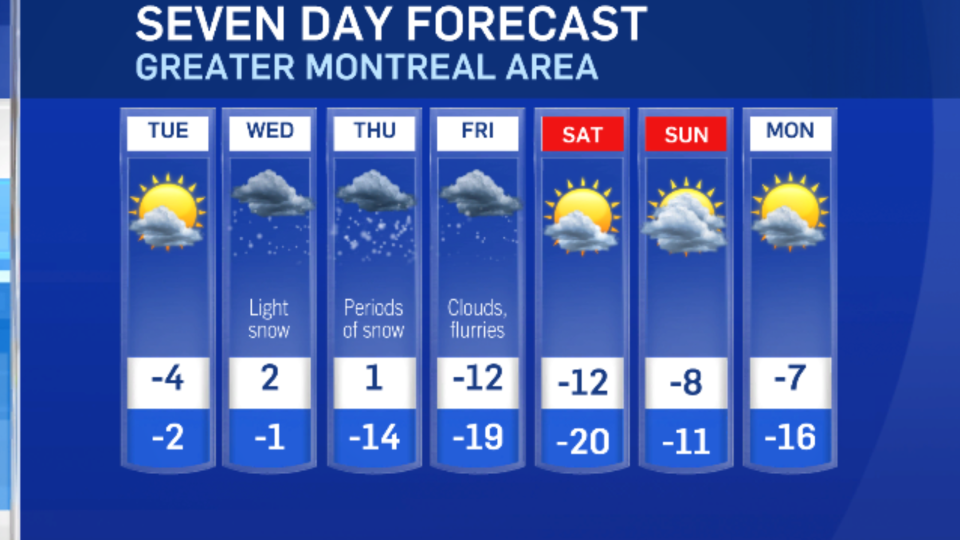
After one of the coldest Januarys in years, a warm-up is on the way for southwestern Quebec. The start of February will bring relief from the extreme cold, but get ready to shovel with accumulating snow on the way.
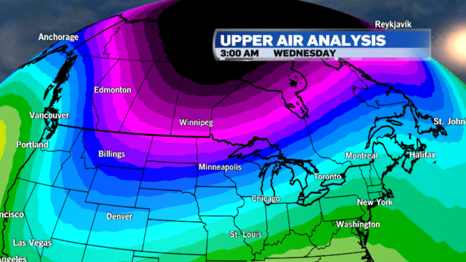
This week, the country will experience a pattern shift. Colder air will be sliding into Western Canada, while above-average temperatures are expected for the east.
Temperatures in Montreal are even expected to be above the freezing mark at times on Wednesday and Thursday.
Along with the warmer air, we are also looking at a more active storm track. Light snow, possibly mixing with rain at times, will be moving into Southern Quebec beginning Wednesday morning.
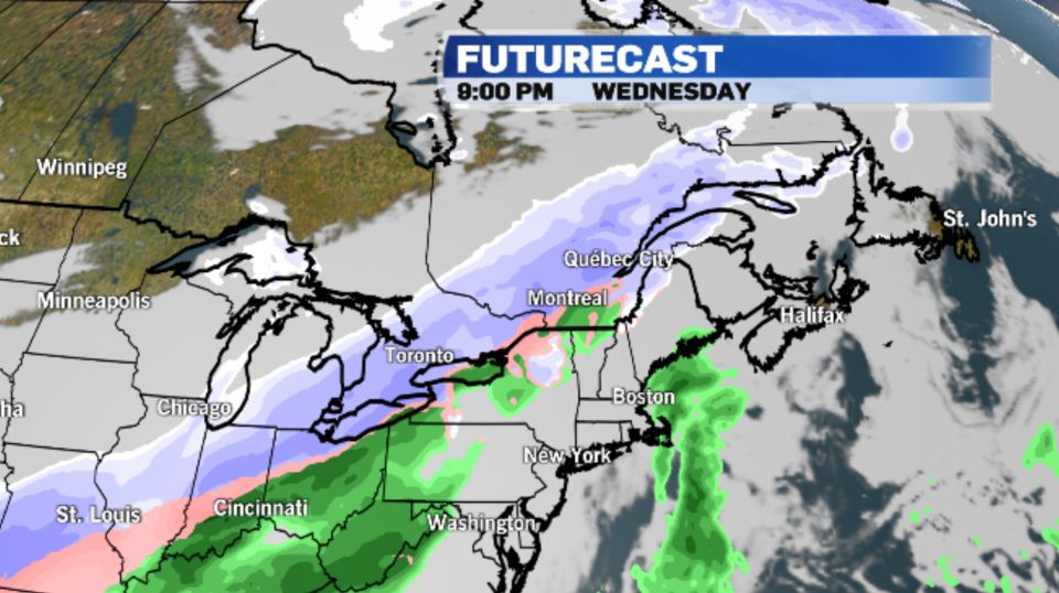
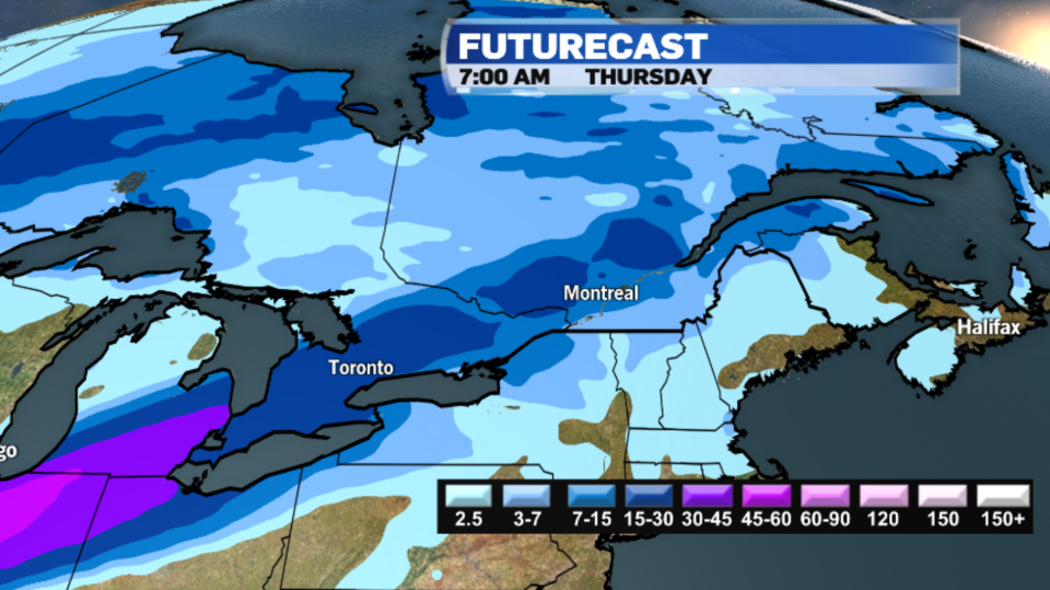
Snow is expected to intensify Wednesday night into Thursday morning and Montreal could see upwards of 15 cm of accumulation. Even heavier amounts are forecast for parts of southern Ontario. Tricky travel is expected.
As the snow moves out through the day on Friday, temperatures will drop back below average.
