A severe thunderstorm watch issued by Environment and Climate Change Canada for the Montreal area earlier in the day Friday has now ended.
The weather watch ended at 5:34 p.m.
Our earlier story is below.
After a stretch of high heat, that included some record-breaking temperatures, Southwestern Quebec is bracing for a pattern change that will feature some strong storms and cooler temperatures.
A cold front moving across the province today will trigger showers and isolated thunderstorms. Some of those storms could be severe in nature, prompting Environment and Climate Change Canada to issue, severe thunderstorm watches.
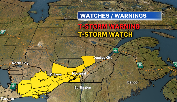
Some of the storm cells will be capable of producing very strong wind, gusts, large hail, and heavy rain this afternoon and early this evening.
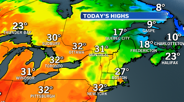
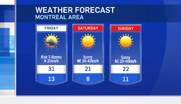
Ahead of that cold front, Montreal could see another record-breaking hot day with a forecast high of 31 degrees Celsius. The record for June 2 at Dorval is 30.4° set in 2014.
The temperature hit 34.3 C on Thursday, setting a new record for Dorval for June 1.
Thunderstorms that rolled across parts of the province on Thursday have cooled the temperatures over eastern regions of Quebec.
Montreal is expecting to see temperatures drop Friday night.
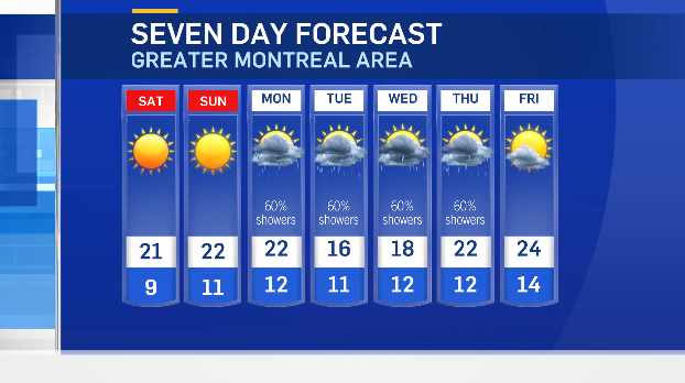
Sunshine will return for the weekend with daytime highs closer to seasonable values. Cooler air will move in Saturday night, and Montreal could see an overnight low in the single digits, which will mean a chilly start for the city’s Tour de l’Ile on Sunday.
A wetter weather pattern will move in for next week with scattered showers in the forecast and daytime. Highs below average on Tuesday and Wednesday.
