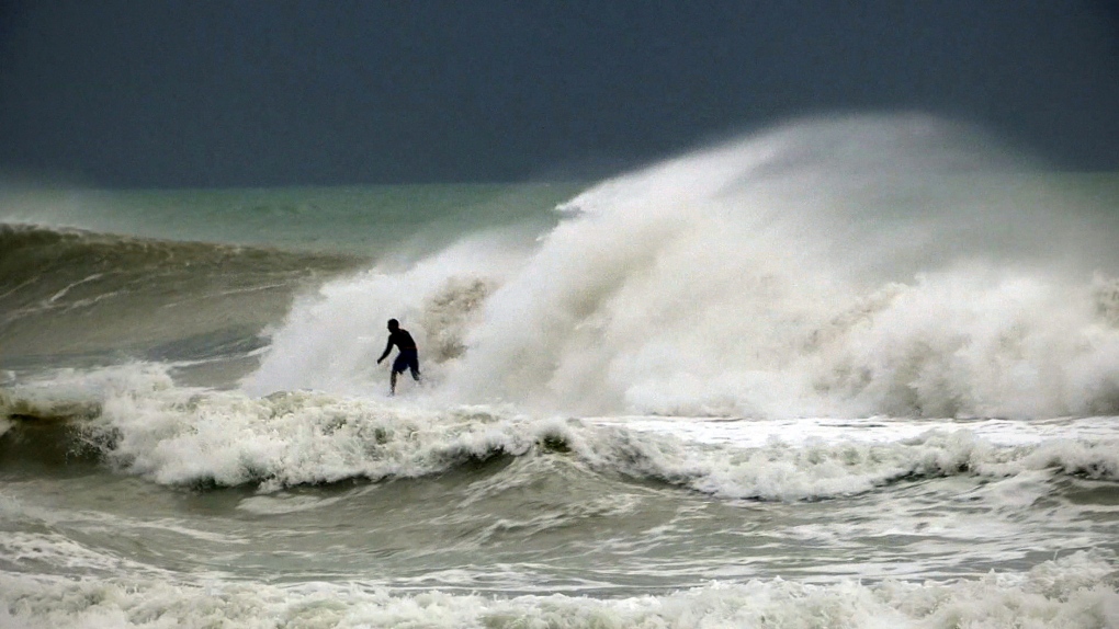
WASHINGTON--When Hurricane Sandy becomes a hybrid weather monster some call "Frankenstorm" it will smack the East Coast harder and wider than last year's damaging Irene, forecasters said Friday.
The brunt of the weather mayhem will be concentrated where the hurricane comes ashore early Tuesday, but there will be hundreds of miles of steady, strong and damaging winds and rain for the entire Eastern region for several days, according to the National Oceanic and Atmospheric Administration.
The hurricane has killed at least 20 people in the Caribbean, and just left the Bahamas. It is expected to move north, just off the Eastern Seaboard.
As of Friday morning, federal forecasters were looking closer at the Delaware shore as the spot it will turn inland and merge with a wintry storm front. But there is a lot of room for error in the forecast and the storm could turn into shore closer to New York and New Jersey and bring the worst weather there.
Wherever Sandy comes ashore will get 10 inches of rain and extreme storm surges, Louis Uccellini, NOAA's environmental prediction director, said in a Friday news conference. Other areas not directly on Sandy's entry path will still get 4 to 8 inches of rain, maybe more, he said. Up to 2 feet of snow should fall on West Virginia, with lighter snow in parts of Ohio and Pennsylvania, regardless of where Sandy first hits.
A wide swath of the East, measuring several hundreds of miles, will get persistent gale-force winds in the 50 mph area, with some areas closer to storm landfall getting closer to 70 mph, said James Franklin, forecast chief for the National Hurricane Center.
"It's going to be a long-lasting event, two to three days of impact for a lot of people," Franklin said. "Wind damage, widespread power outages, heavy rainfall, inland flooding and somebody is going to get a significant surge event."
That storm surge will only be magnified by the full moon this weekend to make it a "dangerous period," Uccellini said.
Last year's Hurricane Irene was a minimal hurricane that caused widespread damage as it moved north along the coast after making landfall in North Carolina. With catastrophic inland flooding in New Jersey, Massachusetts and Vermont, federal officials say Irene caused $15.8 billion in damage.
Sandy is "looking like a very serious storm that could be historic," said Jeff Masters, meteorology director of the forecasting service Weather Underground. "Mother Nature is not saying, 'Trick or treat.' It's just going to give tricks."
Government forecasters said there is a 90 per cent chance -- up from 60 per cent two days earlier -- that the East will get pounded.
Utilities are lining up out-of-state work crews and cancelling employees' days off to deal with expected power outages. From county disaster chiefs to the federal government, emergency officials are warning the public to be prepared. And President Barack Obama was briefed aboard Air Force One.
Boat owners were yanking their vessels out of the water Friday at the Southside Marina in Point Pleasant Beach, N.J., about 60 miles south of New York City.
"We're taking them out as fast as we can," said marina employee Jim Martin.
Atlantic City's casinos made contingency plans in case they have to close, as they did for three days last year when Tropical Storm Irene approached.
Eastern states that saw outages that lasted for days after last year's freak Halloween snowstorm and Hurricane Irene are already pressuring power companies to be more ready this time.
Asked if he expected utilities to be more prepared, Massachusetts Gov. Deval Patrick responded: "They'd better be."
Jersey Central Power & Light, which was criticized for its response to Irene, notified employees to be ready for extended shifts. In Pennsylvania, PPL Corp. spokesman Michael Wood said, "We're in a much better place this year."
New York Mayor Michael Bloomberg on Thursday said the city was striking a tone of calm preparedness.
"What we are doing is we are taking the kind of precautions you should expect us to do, and I don't think anyone should panic," Bloomberg said. The city has opened an emergency situation room and activated its coastal storm plan.
Sandy was expected to deal only a glancing blow to North Carolina's Outer Banks, where Lori Hilby said she planned to ride out this storm at home, unlike past storms such as Irene. Hilby, the manager at Tommy's Natural Foods Market and Wine Emporium in Duck, N.C., said the shop would remain open throughout the storm. She said she sold a fair amount of beer and wine to people who planned to ride out the storm on the barrier island.
"I'll never evacuate again," Hilby said. She said most of the power lines there are underground, so the power often stays on even during powerful storms.
"Whenever I evacuate, I always end up somewhere and they lose power and my house is fine. So I'm always wishing I was home instead of at somebody else's house with no power."
There are still plenty of stores open in Duck, and Halloween decorations and displays were still on houses despite the rain that started to roll in Friday. Few homes were boarded up.
Some have compared the tempest to the so-called Perfect Storm that struck off the coast of New England in 1991, but that one hit a less populated area. Nor is this one like last year's Halloween storm, which was merely an early snowfall.
"The Perfect Storm only did $200 million of damage and I'm thinking a billion" this time, Masters said. "Yeah, it will be worse."
--Associated Press writers Brock Vergakis in Duck, N.C., Tony Winton in Miami, Fernando Gonzalez in Cuba, Ken Thomas on Air Force One, Michael Rubinkam in Harrisburg, Pa., Wayne Parry in Point Pleasant Beach, N.J., and Karen Matthews in New York contributed to this report.


