Snowbanks have been shrinking around Montreal this week with a combination of mild air, sunshine and periods of rain -- but that's about to change.
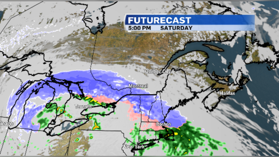
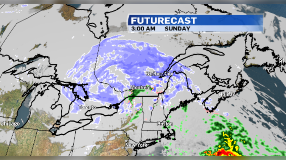
A Texas low is moving into Southern Quebec and is expected to bring wintry weather back for the first weekend of spring.
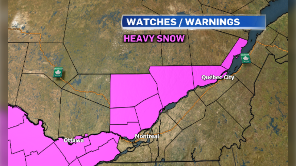
Environment and Climate Change Canada has issued special weather statements for the possibility of heavy snow Saturday afternoon through Sunday morning. Areas north of the St. Lawrence river could see totals reach 20 cm.
Montreal could see five to seven cm of wet snow beginning Saturday afternoon. Strong winds will accompany the low with gusts up to 50 km/h.
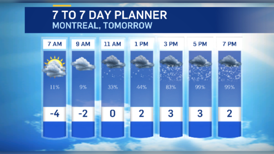
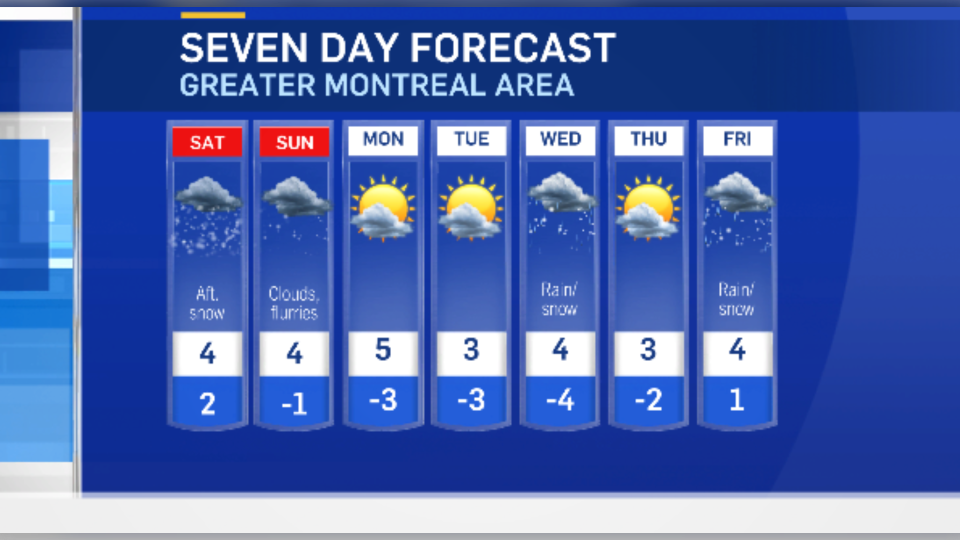
Montreal will see snow change to rain overnight Saturday, with lingering flurries in the forecast through Sunday.
Special weather statements are also in effect for much of Ontario with a mix of wet snow, freezing rain and strong winds.
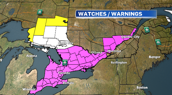
The Ottawa Valley is expected to see wet snow beginning Saturday afternoon, with some areas receiving as much as 10 to 15 cm.
Patchy, freezing rain is expected in the Toronto area Saturday morning before a change over to straight rain Saturday afternoon. Parts of southern Ontario will see wind gusts up to 70 or 80 km/h.
Snowfall warnings have been issued for Northeastern Ontario with up to 20 cm of snow in the forecast.
Montreal will see drier weather beginning Monday, but more mixed precipitation is in the forecast later in the week.