A Texas low is moving into the province and it's bringing a mixed bag of precipitation with it.
Environment and Climate Change Canada has issued freezing rain warnings that cover Eastern Ontario and parts of Quebec, mainly north of the Saint-Lawrence.
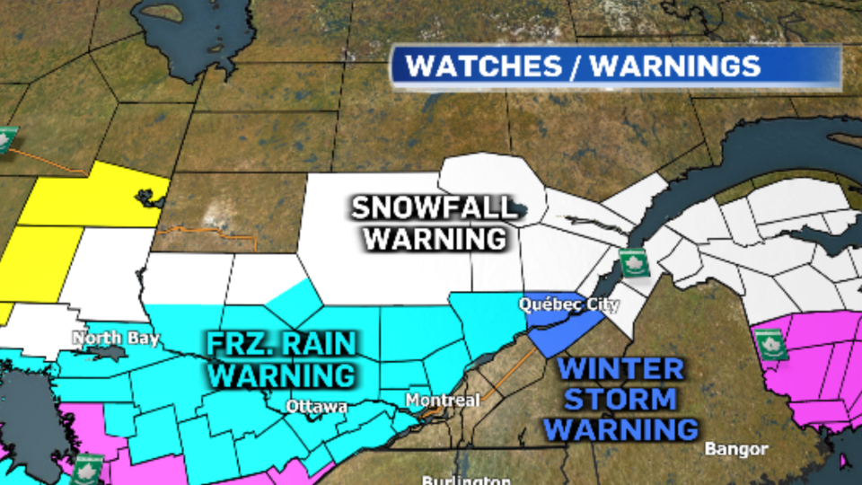 The Ottawa Valley and Lower Laurentians will see about two to five millimetres of freezing rain, beginning Thursday afternoon. Surfaces such as roads and sidewalks could become slick. However, areas around Mont-Tremblant could see five to 10 mm of ice accretion which could result in downed tree branches and possible power outages.
The Quebec City region is bracing for heavy snow with upwards of 20 cm possible.
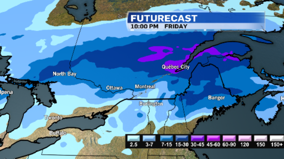 The Montréal-area is expecting about five centimetres of snow beginning Thursday afternoon. Snow is expected to change rain through the evening hours as temperatures continue to climb above the freezing mark. Montreal could see a brief period of freezing rain during the transition.
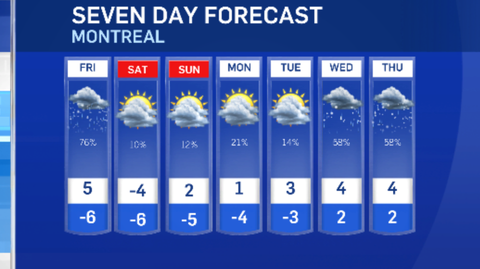
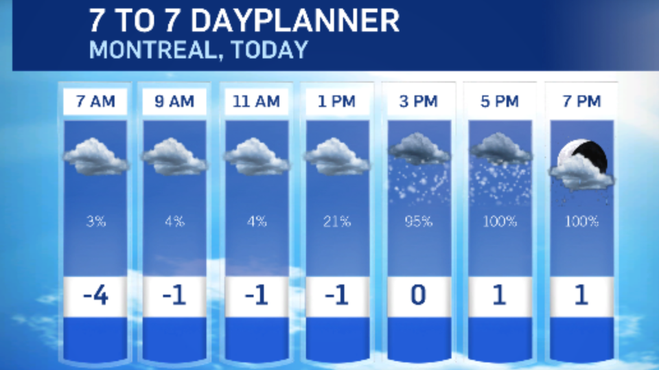 Rain will change back to snow in Montreal on Friday but little accumulation is expected. Friday will be marked by strong winds with gusts up to 70km/h.
Sunshine will return for the weekend. Temperatures will be closer to seasonal on Saturday, but will jump back above the freezing mark beginning Sunday and mild conditions will persist through next week.