
The final week of winter will feature more snowy weather for Southwestern Quebec.
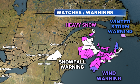
A low-pressure system over the U.S. Northeast will bring light snow into Montreal through the day on Tuesday. However, snowfall warnings are in effect for the Eastern Townships with up to 20 cm of accumulation in the forecast through Tuesday night.
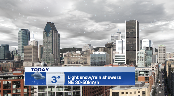
Montreal will see wet snow mixed with rain showers through Tuesday evening. Although temperatures will climb above the freezing mark, breezy northwesterly winds will make it feel colder.
The low low-pressure system will be swinging into Atlantic Canada through Wednesday and parts of the Gaspe peninsula could see up to 20 cm of snow. Cape Breton is expected to be hardest hit with 15 to 25 cm.
Later this week, another system will be pushing into Central Canada bringing heavy snow to parts of Ontario and Quebec for St. Patrick’s Day on Friday.
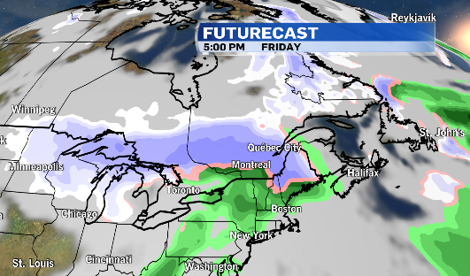
Montreal is expecting to see a rain/snow mix on Friday, followed by cooler air for the St. Paddy’s Day parade on Sunday.
Parade goers, and organizers will need to bundle up on Sunday. Montreal will see a morning temperature of -5 degrees Celsius and a wind chill around -13. The afternoon high on Sunday is only expected to be -1 C, but gusty westerly winds of up to 60 km/h. Will make it feel closer to -9.
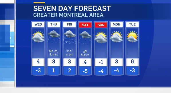
Astronomical spring begins Monday, March 20.


