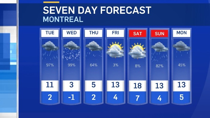
MONTREAL -- We all know April showers bring May flowers, but April snow? That’s what parts of Quebec are bracing for Wednesday into Thursday as spring flowers start to bloom.
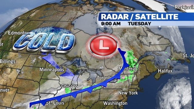
A cold front sweeping across the province on Tuesday will bring light rain to southern Quebec but more importantly, it will open the door to a pool of cold air. Daytime highs in Montreal on Wednesday and Thursday will be 7 to 9 degrees Celcius below average and overnight lows will be close to the freezing mark. With more moisture moving up from the U.S., the next round of wet weather is expected to fall as snow.
Montreal could see 2 to 4 centimetres of wet snow beginning Wednesday morning into Thursday. The record snowfall for April 21 is 0.8 cm. The record snowfall for April 22 is 0.8 cm.
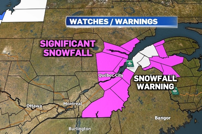
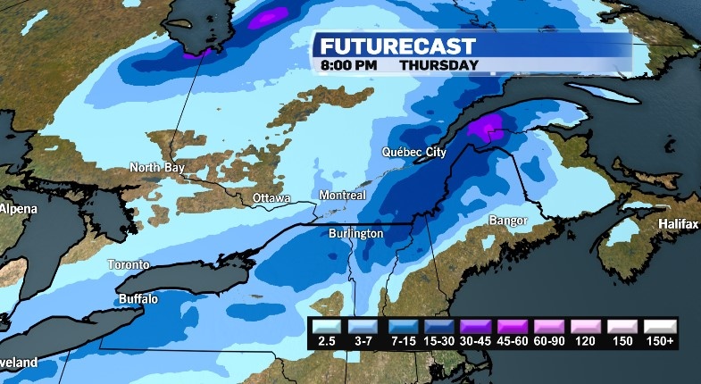 But areas east of the city are bracing for much more. Environment and Climate Change Canada has issued special weather statements to warn motorists and pedestrians to brace for significant snowfall that could result in dangerous road conditions and very slippery sidewalks. The most affected areas will be the Eastern Townships, the Beauce and the Lower Saint Lawrence where snowfall amounts could be exceed 15 cm.
So far this spring, snowfall amounts in Montreal have been well below average. The city only received 2.2 cm of snow in March compared to an average of 36.2 cm. So far this April, Montreal has recorded less than 1 cm of snow, while the city usually sees an average of 12.9 cm for the month.
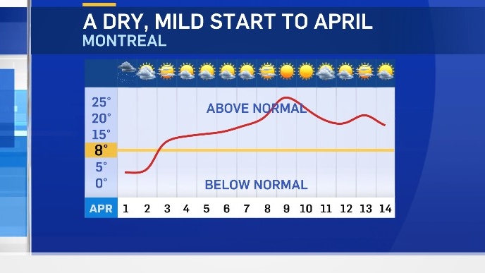
Aside from light snowfall that fell on April 1, the first half of the month featured a stretch of sunny mild weather in Montreal.
Any snow that does fall this week, is sure to melt quickly. Sunshine returns on Friday along with above average temperatures to kick off the weekend.