
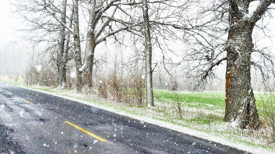
MONTREAL -- Montreal got hit with record-breaking snow on Wednesday as the temperature plunged below the freezing mark.
As of 4 p.m., five centimetres of snow had fallen on the city, breaking the old record of 0.8 centimetres in 1963.
Visibility was reduced to just over one kilometre at times during the day.
Temperatures were also unseasonably cold. The afternoon temperature in Montreal stayed below the freezing mark, hovering around -1 degree Celsius, while the average daytime high for April 21 is 12 degrees Celsius.
Steady snow is expected to taper to flurries through Wednesday evening and should come to an end after the evening rush-hour.
Clouds will continue to linger into Thursday, as temperatures slowly begin to bounce back.
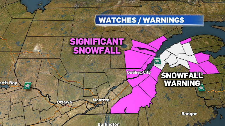
Snowfall is expected to be more intense east of Montreal, with Environment and Climate Change Canada issuing special weather statements for amounts in excess of 15 centimetres.
Meanwhile, the Lower Saint Lawrence is under snowfall warnings with totals between 15 and 30 centimetres in the forecast.
Motorists in these areas were being warned to brace for dangerous travel conditions, especially as some may have already switched from winter to summer tires.
Late-season snow should melt rapidly, however, as temperatures are expected to bounce back to near seasonal on Friday in Montreal with plenty of sun.
The forecasted high in the city is expected to climb to 18 degrees for the start of the weekend and April showers are back in the forecast on Sunday.


