
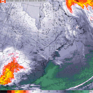
A massive winter storm blew into Eastern Canada Wednesday. The Texas low swept across Southern Ontario beginning Wednesday morning before arriving into southwestern Quebec into the evening hours.
Environment and Climate Change Canada issued snowfall warnings for the Montreal area with 15 to 25 centimetres of accumulation expected.
Snowfall warnings are also in effect for areas north of the city, like Lachute, Saint-Jerome and the Lanaudiere. Regions south of Montreal, down toward the U.S. border and toward the Eastern Townships, are also under the warning and could see similar amounts.
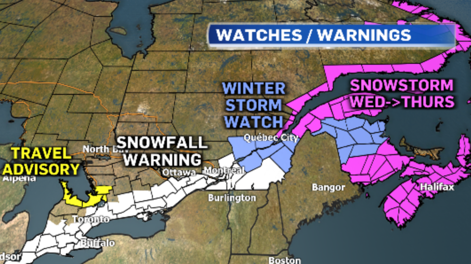
Snow will also be accompanied by moderate winds, causing blowing and drifting snow on the roads. Winds will be even more intense in the Quebec City region, where Environment Canada has issued winter storm warnings.
Reduced visibility in those areas could cause hazardous travel conditions.
The snow started to fall in Montreal during the the evening rush hour and is expected to intensify throughout the evening.
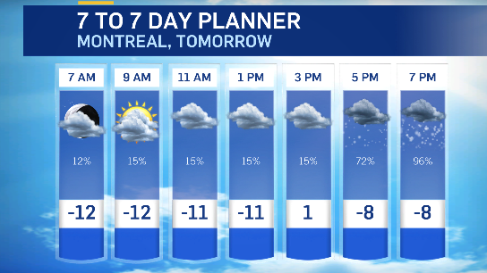
Montreal could see about 15 centimetres of snow on the ground by midnight.
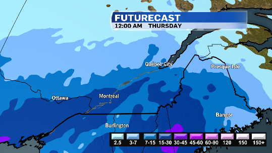
Snow will continue to fall during the Thursday morning commute, making for a difficult drive.

Another five to 10 centimetres could fall during the day on Thursday before tapering to flurries in the afternoon.

Skies will clear out on Thursday night and temperatures will drop.
The sun will return on Friday but daytime highs will be in the minus double digits for the first time this season.
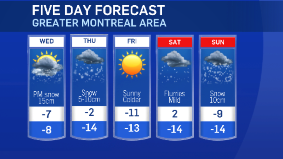
More snow could be on the way on Sunday.
MONTREAL STORM WATCH
- Environment Canada weather alerts - southern Quebec
- Hydro-Quebec outages by region
- STM bus line status
- Metro service updates
- Montreal-Trudeau Airport Departures | Arrivals
- Exo commuter train status
- Via rail trains status
- City of Montreal snow removal, parking, towing
- Free parking spots
- My car was towed
- Laval snow removal operations
- Longueuil snow removal operations


